Home/ Reports/ Residential Area Strike, Cherkasy

Drone Strike on a Residential Area in Cherkasy: Environmental Footprint
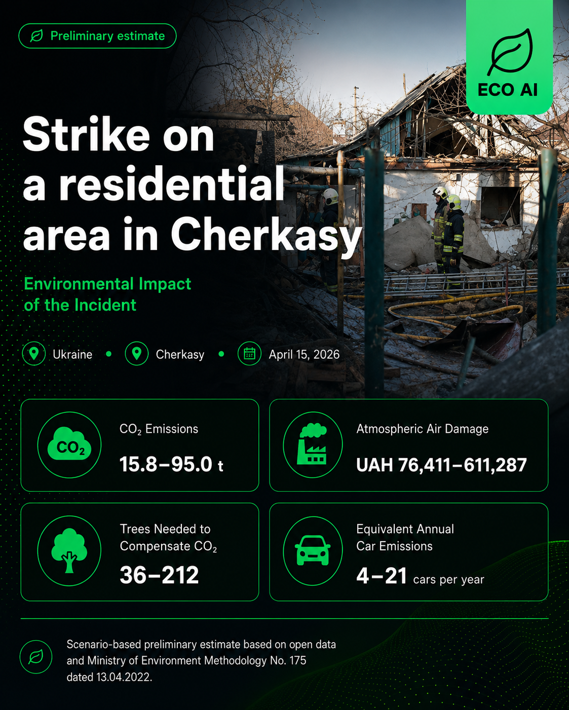
📍 Cherkasy 📅 April 15, 2026 🏘️ Residential Area Preliminary estimate
Drone Strike on a Residential Area in Cherkasy — Environmental Impact, ECO AI
💨
CO₂ Emissions
15.8–95.0 tonnes
🏭
Atmospheric Air Damage
76,411–611,287 UAH
🌳
Trees to Compensate CO₂
36–212 trees
🚗
Equivalent Annual Car Emissions
4–21 cars/year

What Happened

On the night of 15 April 2026, Russian attack drones struck Cherkasy. Drone impacts and falling debris were recorded at several locations across the city, including a private residential area. According to updated reporting, three houses were completely destroyed and approximately ten more were damaged. Outbuildings and vehicles were also affected.

Ukraine's State Emergency Service confirmed fires in two residential buildings and a bus. All fires were extinguished. Five passenger vehicles were destroyed and four others were damaged.

Preliminary Environmental Assessment

Analysis

The assessment uses an estimated affected residential area of 1,000–5,000 m² and a scenario-based burned area of 200–1,200 m². The exact duration of the fires was not established in open sources, so coefficients for an unknown duration or burning lasting up to 12 hours were applied. The lower bound represents the minimum fire scenario involving the primary damaged objects, while the upper bound reflects an expanded scenario within the same residential area.

Materials that may have burned include wooden structures, furniture, roofing and polymer-based materials, cable insulation, household appliances, vehicle tyres, fuel and lubricants. Potential emissions include CO₂, smoke, soot, ash, fine particulate matter and products of incomplete combustion.

🏗️ Construction Waste & Contamination Note: The destruction of houses and outbuildings generated mixed construction waste — fragments of brick and concrete, glass, metal, wood, insulation, roofing materials and plastics. Damage to vehicles and utility networks may have created additional risks from fuel, lubricants and household substances entering the soil or surface runoff. This is a scenario-based inventory and does not replace laboratory analysis of air, soil, water or generated waste.

The tree estimate relates exclusively to conditional compensation for CO₂ emissions, assuming planting and maintenance for at least 10 years. Trees do not neutralise soot, dust, ash, heavy metals, plastics, fuel and lubricants, soil contamination or hazardous waste.

Methodology: The assessment is based on open-source information and Ukraine's Ministry of Environmental Protection Methodology No. 175 of 13 April 2022, registered by the Ministry of Justice of Ukraine on 16 April 2022 under No. 433/37769. Methodology No. 175 establishes the approach for calculating unorganised emissions and atmospheric-air damage during emergencies and martial law. The range reflects minimum and maximum scenarios for the affected area.
Disclaimer: This is a preliminary assessment based on open-source information. The figures represent minimum and maximum scenarios and are not an official calculation by state authorities. The assessment confidence is low. A more accurate result requires official information on the area and duration of each fire, the exact area of the damaged properties, the composition and mass of burned materials, the volume of generated waste and laboratory measurements.
ECO AI

More Damage Reports

Browse all preliminary environmental damage assessments published by ECO AI.

📊 All Reports ← Back to Home